.
January 15-16
Sailing Fjords
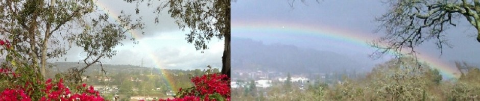
It’s been lovely. Except when we had to scoot out of the fjords for a bit to the Pacific. I hadn’t taken any Dramamine because the fjords were smooth. Then about 5 p.m. things started rockin’ and rollin’ but not before I decided to go ahead and have an adult beverage while Al and I played cards. (I’d like to point out that I’ve had much better luck playing solitaire this trip than playing against Al. He’s just been crazy lucky). By 6 p.m. I knew the adult beverage was a mistake. Went back to the room and downed half a Dramamine and then an hour later the other half and finally settled down. I never get truly sick but the day was over for me with just room service for a sandwich and a ginger ale. Didn’t dare stand up.
This morning we awoke to more of the same, fjord wise. Every day at 10 and 11 there are enrichment lectures by experts. Dr Neil Gilbert and Jim McParland. They are excellent and I wish I could just relate to you everything they tell us, but that would obviously be impossible. The first lecture by McParland was on the Ring of Fire which, living on the Ring of Fire, I am aware of, but it was quite astonishing how many active volcanoes there are along it all over the world. His map of little red dots was impossible to count due to lots of little red dots overlapping. Between that and having watched a series of lectures on The Great Courses (Now Wondrium) I’m finding myself enchanted by how volcanoes form, tectonic plate theory and just geology in general. The first lecture by Dr. Gilbert was about Antarctica in general – a land of superlatives. This will either depress you or give you hope, but Antarctica is the only continent that has not experienced extinctions due to human activity despite, as Dr. Gilbert said “we had a good go at it” by hunting whales and seals. The continent is now well protected by international agreement and even dog sleds are no longer allowed. The most interesting thing I learned is that all currents in the ocean start in Antarctica. The current goes round and round the continent and then heads off to the rest of the world in several directions like kids flying off playground carousel, carrying nutrients and critters along with it.
Yesterday Dr. Gilbert gave a great lecture on the science stations on the continent. Some are temporary in the summer and some are year round. Crazy stuff and they’ve come a long way since the beginning, including “pack it in, pack it out” mentality. Used to just dump the garbage but it was all cleaned up and hauled away now it is packed out from the get go. Then on the other end someone unpacks it all again to recycle or whatever, hopefully not throw it back into the ocean.
He showed slides of stations that were built like circular tubes, knowing that they would be covered with snow and could withstand the forces. Eventually they accessed the tunnels through a vertical entrance on the roof that subsequently was built higher and higher and the ladder down into the tube longer and longer.
Now the stations are built on skis and pods and can be moved around. They include solar panels and wind power. For the permanent stations cargo ships come once a year to bring supplies.
What’s the deal with studying science on Antarctica? You name it – geology, biology, weather, chemistry. The international Council of Managers of Antarctica have declared “Antarctica a natural reserve dedicated to peace and science”. Lets not screw it up, eh?
A few positive developments: long line fishing that involved long lines and any baited hooks were also catching sea birds. Humans figured out how to do things differently so that problem doesn’t occur anymore. The scientists are busy monitoring populations of sea life to ensure that in trying to feed ourselves we don’t starve out the seals, etc. Not all loss of animal life is due to us humans. A volcano on one of the islands in southern south America decimated a penguin colony of 250,000 because the youngsters were in molting season and could not escape into the ocean because they couldn’t swim yet.
You may have heard that there is good news re: the ozone layer healing itself sooner than expected. The measurements of the ozone layer began in 1956 and in the late 70’s/80’s it was noted that it was getting larger thus endangering us and other species with too much UV. The Montreal protocol went into effect in 1987 – I think we all remember when CFCs were banned and there was a clearer understanding of what was going on – and here we are, fixing what we broke.
I have often said that despite the doom and gloom of climate change I have faith in science and the future generations to figure this stuff out and fix it. Our very survival depends on it and barring the bad guys blowing us all up there is hope for us to not completely destroy our beautiful Mother. We can be smarter than that, can’t we?
Jim McPartland has told us how fjords form and wow there are a lot of them all over the world. Essentially they formed where there was a preponderance of ice during the ice age. Where the glaciers formed u-shaped valleys and then melted away and the melted waters joined the sea – fjord. Interesting fact that they tended to leave a lot of silt at the joining of the ocean and inlet, leaving a “sill”. Ships have to be kind of careful going over those and it depends on things like tides as to when they can be traversed.
We went over one today that was literally three feet under the ship which the captain informed us is why we were going sooooo slowly! (Back going fast now, I took a Dramamine).
Looks like it will be calm enough that we are actually going to be able to traverse Cape Horn which is not always the case. On these adventure type cruises you have to be ready for anything – such as missing the port earlier in the trip – or getting to really truly go around Cape Horn because the seas are calm. Wherever we go it is going to be fabulous with a highlight being Glacier Alley. Have to get my butt out of bed early for that one to see it start to finish – 6:30 a.m.
Had a nice geography lesson of all the archipelagos and the Antarctic peninsula and in order to grasp it all I’m going to have to get on the internet and really study the map, so there’s no hope of me describing it here. Basically he told us – “well we could go through this channel or that channel and hopefully we can go through this channel but if not this one is also a cool channel”.
For those of you like me who is obsessed with the story of Shackleton and his ship The Endurance that got stuck in sea ice, he showed us the map of the route Shackleton and five crew members took when they went for help in an open boat the size of one of our lifeboats in a three week journey from Elephant Island to South Georgia. 800 miles. Check out a map. And then consider it was winter. The dude was (insert your own adjective. Words fail me. I love this guy).
